Barahona
South Region, Barahona
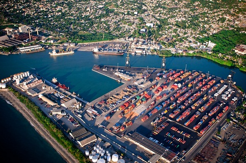
Is located in the city of Barahona at latitude 18° 12 N and longitude 71° 04 W. It has four berths totaling a length of 659 meters, with a draft of 10.8 meters, an input channel of 110 meters, 36 feet deep and maneuvering a circle of 200 meters, is used to load loose salt, gypsum, coal, clinker and fuels.
The Central Sugar Corporation and power generation company EGE-Haina are the main users of this port in the conduct of its operations under contract with the Dominican State.
Geographical Position
- Lattitude: 18º - 12.‘ N
- Longitude: 71º - 04.‘ W
Technical Data
- Time Zone: -4 GMT
- Tidal Variation: 0.50 M
- Dock Length: 200 – 550 lineal mts
- Docks Depth: 35 fts
- Breth´s Depth: 34 fts
- Arrival Channel: 110 lineal width mts
- Arrival Channel´s depth: 36 ft
- Manioubre Circle: 200 mts
- Berths:4
- Beacon: 9 buoys (1 landfall, 3 reds, 3 green y 2 yellow)
- Lining: 2430
- Lighthouse: N/A
Operations
- Exportation: Dry bulk: Cast / Salt / Cement
- Added Materialss: Cane Sugar
- Importation: Mineral coal