Azua
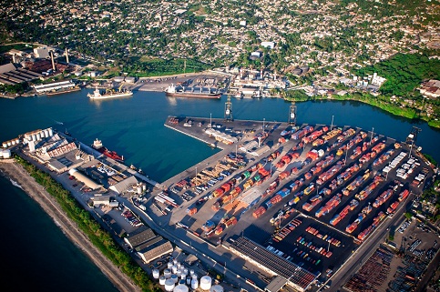
Located at the southern end of the province of Azua, at latitude 18 ° 30 N and longitude 70 ° 40 W, Puerto viejo has a spring-shaped pier with 200 meters long and 38 meters wide, with a draft of port of 34 feet, an inlet channel 140 meters wide and a depth of 9.14 meters, and his circle of maneuver of 330 meters.
It was built in 1959 with the aim of exporting sisal which was harvested in the region.
After the fall of the Trujillo tyranny, the port fell into disrepair and years later, in the left wing company LPG Opuvisa for the reception and storage of fuels was installed, while the right side is kept for occasional loading and unloading goods in general.
Geographical Position
- Lattitude: 18º - 20´. ‘N
- Longitude: 70º - 49. ‘W
Technical Data
- Time Zone: -4 GMT
- Tidal Variation: 0.50 M
- Estructure: Shaped breakwater
- Dock Lenght: 210 mts
- Width: 30 Mts
- Ports Depth: 9.14 mts
- Depth of berth: 27 ft
- Arrival Channel: 140 lineal witdh mts
- Arrival Channels Depth: 30 ft
- Manioubre Circle: 330 mts
- Berths: Shaped Breakwater
- Beacons: 8 buoys(4 green, 4 reds)
- Lining: No
- Lighthouse: N/A
- Recommended directions For docking: -0660 por 544 yds -3350 por 539 yds -0410 por 646 yds -0100 por 773 yds
Operations
- Loading and unloading
- Receiving vessel : cargo , bulk , tanker , tug , barge