La Romana
East Zone, La Romana
Resposible Enterprise: Central Romana
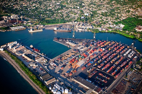
Located in the east of the country, the port is located at the mouth of the Chavon River, at latitude 18 ° 26 N and longitude 68 ° 57 W has a draft of 34 feet, a dock length of 100 meters, a circle of maneuver of 240 meters and an inlet channel 60 meters wide and 40 feet deep. It was built in the 50s by the Golf & Western Corporation.
Originally it used primarily for the export of sugar and molasses and today has been incorporated into the handling of containers of the Free Zone, supply of materials and equipment for hotels.
A modern tourist Terminal (Home Port), to the east bank of the Chavon River for cruises, which have allowed putting the country at the height of the top destinations in the Caribbean, was recently built.
Geographical Position
- Lattitude: 18º - 27‘ N
- Longitude: 69º 18‘ W
Technical Data
- TIme Zone: -4 GMT
- Tidal Variation: 0.50 M
- Docks Depth: 100 Metros
- Length West Bank: 220 mts
- Oriental Margin length : 200 mts
- Depth: 11.3 Mts
- Draft: 34 ft
- Arrival Channel: 60 mts (width) / 40 ft (depth)
- Arrival Channel Depth: 240 mts
- Manioubre Circle: Occidental Margin- Cargo Management/(220 mts lenght)/ Oriental Margin – Passenger´s Management (200 mts Lenght)
- Beacon: 2 buoys (1 red, 1 green)
- Lining: 3460
- Lighthouse: White and Black Steel Tower / Flare 1 Secs / Period 6 Secs / Reach 15 M / Elevation 90 ft
- Segurity: PBIP Code
Operations
- Load and Unload: Sugar / Fuels / Cruise Ships Management
Ships Reception
- Freighter: Bulk / Tanker / Tug / Barge
Importation
- General Cargo Release
- General Containerized cargo
- Solid General Cargo
- Liquid General Cargo
Exportation
- General Containerized cargo
- Solid General Cargo
- Liquid General Cargo