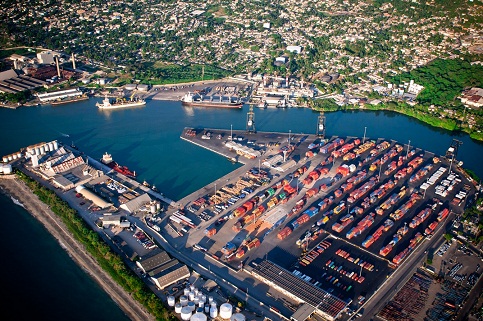
Puerto Plata
North Zone, Puerto Plata.
It is located on the north coast, in the province of the same name, at latitude 19 ° 49 N and longitude 70 ° 42 W. It has a draft of 42 meters in port, an input channel of 115 meters, a circle of maneuver of 300 meters and a depth of 60 feet.
It is considered the third most important port in the country with two springs for the conduct of its operations, handles general cargo and serves as a location for sightseeing cruises.
The port terminal of Puerto Plata shares operations and management between the private sector and the Dominican State.
Geographical Position
- Lattitude: 19º - 49. ‘N
- Longitude: 70º - 42. ‘W
Technical Data
- Time Zone: -4 GMT
- Tidal Variation: 0.75 M
- Port Depth: 9.16 mts
- Berths Depth: 9.1 Mts
- Arrival Channel: 12 Mts
- Manioubre Circle: 400 mts
- Berth Type: Breakwater Shaped
- Beacon: 5 buoys (1 landfall, 2 green, 2 red)
- Lining: 2180
- Lighthouse: Yellow Steel Tower Glare : 2 secs Period : 6 secs Reach : 18 miles Elevation: 137 ft
Operations
- Load and Unload
- Fuel
- Containers
- General Cargo
- Tourist Ship